
Sinza’s Urban Productivity Test: Can Dar es Salaam Create More Value From the Same Land Without Creating More Disorder?
Ready
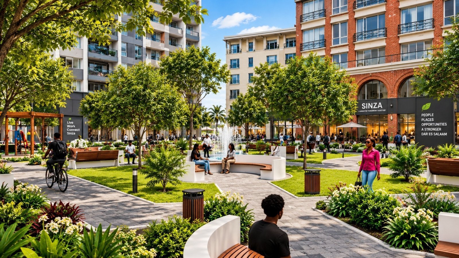
The Sinza Redevelopment Plan 2026–2046 gives the answer in unusually clear numbers. The area covers only 3.37 square kilometres, or 336.78 hectares, yet it sits between Sam Nujoma Road, Shekilango Road, Mwenge, Ubungo, Mlimani City and some of Dar es Salaam’s busiest commercial and institutional corridors. It is already largely built out, with 96.4 percent of surveyed plots and buildings completed and only 1.6 percent vacant. But it is also underbuilt: 94 percent of structures are still single-storey, while only 6 percent are multi-storey.
Sinza’s redevelopment should not be read only as a neighbourhood planning exercise. It is a test of Dar es Salaam’s next urban economy.
For decades, Dar es Salaam has grown by spreading outward. New housing has moved farther from jobs, commuters have travelled longer distances, and infrastructure has often followed population pressure rather than shaping it. Sinza presents a different question: what happens when a mature, centrally located neighbourhood has almost no vacant land left, but its economic value keeps rising?
The Sinza Redevelopment Plan 2026–2046 gives the answer in unusually clear numbers. The area covers only 3.37 square kilometres, or 336.78 hectares, yet it sits between Sam Nujoma Road, Shekilango Road, Mwenge, Ubungo, Mlimani City and some of Dar es Salaam’s busiest commercial and institutional corridors. It is already largely built out, with 96.4 percent of surveyed plots and buildings completed and only 1.6 percent vacant. But it is also underbuilt: 94 percent of structures are still single-storey, while only 6 percent are multi-storey.
That is the real story. Sinza does not lack land. It lacks a system for making land more productive. The report describes Sinza as one of Dar es Salaam’s “strategic and rapidly transforming urban neighborhoods,” a phrase that captures both its opportunity and its risk. The neighbourhood is valuable because it is already connected, already serviced, already known by the market and already located near major economic nodes. But the same forces that make it attractive have also pushed it into land-use conflict, congestion, open-space loss and infrastructure stress.
This makes Sinza different from greenfield expansion on the edge of the city. In a greenfield area, government and developers can still draw roads, utilities, plots and public spaces before the market arrives. In Sinza, the market is already there. Houses have become shops. Residential plots have become hostels, bars, groceries, offices, lodges and apartments. Road reserves have absorbed parking. Open spaces have been invaded. Infrastructure designed for a smaller, lower-density settlement is now carrying a mixed-use urban economy.
The plan’s deeper question is therefore not whether Sinza should change. It already has. The real question is whether Dar es Salaam can organize that change into a higher-value urban district instead of allowing it to continue as scattered private construction.
A 1970s residential plan has become a 2040s urban economy
Sinza was planned in 1973 under the Government’s Site and Services Project, implemented with the World Bank, to provide serviced plots for low-income households relocated from Manzese. The original layout provided standard 288-square-metre residential plots, designed for single-storey family houses, together with public open spaces, water kiosks and essential community facilities.
That model has been overtaken by Dar es Salaam’s growth. The report says Sinza has evolved from a “purely low-density residential neighborhood” into a mixed-use zone characterized by commercial activity, multi-storey development and intensified land use. It also links that pressure to nearby hubs such as Mlimani City, Mwenge and Ubungo.
This is the first economic reading: Sinza is not suffering from a lack of investment. It is suffering from unmanaged investment.
The market has already decided that Sinza is too strategic to remain a low-density residential estate. The planning system is now trying to catch up with that market reality. The danger is that private value may keep rising while public systems weaken. When that happens, the city gets taller buildings and higher rents, but also narrower access, blocked drains, fewer open spaces, weak parking, poorer walkability and higher long-term infrastructure costs.
The report says the redevelopment plan aims to “restore the value, functionality, and urban character” of Sinza while positioning it as a well-planned, resilient and vibrant urban neighbourhood. That is a useful way to frame the task. Sinza is not a blank canvas. It is a valuable urban asset that needs reorganization.
The population decline hides an economic shift
Sinza’s population fell from 40,546 in 2012 to 31,396 in 2022, a decline of about 23 percent. Read carelessly, that could suggest a neighbourhood losing importance. The report’s own explanation points in the opposite direction. It attributes the decline to migration to newer areas, smaller household sizes, conversion of residential houses into commercial premises, rising property costs and relocation of some formal workers to Dodoma and outer suburbs.
This is not simple decline. It is urban restructuring. Sinza is becoming less of a conventional residential settlement and more of a mixed urban economy with residents, tenants, traders, students, customers, workers, commuters and service operators using the area at different times of the day. The household data supports this. Average household size dropped from about four people in 2012 to about three in 2022, while the number of households remained stable or rose slightly, which the report identifies as a typical urban trend.
The redevelopment plan assumes that density will return people to Sinza. It projects the resident population rising to 37,288 in 2027, 44,291 in 2032, 52,606 in 2037, 62,477 in 2042 and 71,489 by 2046. Employment is also projected to increase from 10,000 in 2026 to 21,891 in 2046, led by services, retail, offices and other urban activities.
That changes how the plan should be judged. The issue is not only how many people sleep in Sinza. It is how many people use Sinza. A neighbourhood with a declining resident population can still face rising economic pressure if shops, offices, transport services, schools, clinics, hostels, restaurants and informal businesses expand. That is exactly what Sinza appears to represent: a place where daytime activity, land values and commercial pressure are rising even as traditional household residency has weakened.
Sinza is built out, but economically underbuilt
The strongest argument for redevelopment is that Sinza has very little room left for horizontal growth. The area has 4,686 plots, of which 3,980 are developed with single-storey buildings and only 255 with multi-storey buildings. Its land-use structure already shows a mixed economy: residential land covers 112.94 hectares, commercial land 31.34 hectares, commercial-residential land 31.19 hectares, institutional land 58.79 hectares, roads 67.23 hectares and unplanned settlement 23.37 hectares.
The report’s later assessment is sharper: 94 percent of structures are single-storey and only 6 percent are multi-storey, a pattern it describes as inefficient land utilization in an area with high land value and development pressure.
For Dar es Salaam, this is the new frontier of real estate value. Sinza is not cheap peripheral land. It is serviced urban land located near demand. The question is whether that land should continue producing one-storey returns in a multi-storey economy.
The report shows that 96.4 percent of surveyed plots and buildings are completed, while only 1.6 percent are vacant and 2 percent are under construction. It concludes that Sinza is a mature and consolidated urban area where future development must depend on redevelopment, densification, plot amalgamation and vertical expansion rather than greenfield growth.
That is the investment case, but also the warning. A built-out neighbourhood cannot absorb density casually. Every additional floor, shop, apartment, office and parking bay has to be supported by roads, drains, sewerage, water, electricity, fire access, pedestrian space and solid-waste systems. Sinza’s underused land is an opportunity only if infrastructure rises with value.
The open-space collapse shows what unmanaged value destroys
The most concerning data in the report is not about buildings. It is about public space.
Sinza originally had 40 planned open spaces. By 2024, only 13 remained open, while 27 had been encroached. In percentage terms, 67.5 percent of planned open spaces had been lost or converted.
That is not just a planning statistic. It is a measure of urban stress. Open spaces are not empty land waiting for higher-value use. They are part of the infrastructure of livability. They support air circulation, social life, recreation, emergency shelter, drainage, urban cooling and mental health. Once converted into parking, temporary trading, private structures or public offices, they become difficult to recover.
The same pattern appears in the water-kiosk system. The 1974 plan reserved 207 water-kiosk sites, but the report says 156 have been developed and only 51 remain undeveloped. It also notes that many access routes around these sites have been blocked.
This is why the Sinza plan should not be judged by towers alone. A redevelopment that increases floor area but fails to recover public space would be a financial success and an urban failure. The stronger test is whether Sinza can densify while restoring open spaces, protecting water corridors, improving walkability and creating a more liveable neighbourhood.
Roads, parking and pedestrians are the productivity constraint
Sinza’s location gives it strong external connectivity. The report notes that the area is served by major transport infrastructure, including Morogoro Road, Sam Nujoma Road and Shekilango Road, while also being close to UDSM, Ardhi University, the School of Law, the Water Institute, Mlimani City and East Africa Commercial and Logistics Centre.
But internal mobility is weak. The report says 86.9 percent of roads are between 3 and 6 metres wide, while only 13.1 percent fall between 15 and 70 metres. It also states that nearly all existing roads lack pedestrian walkways or pavements, forcing pedestrians to use road shoulders and carriageways.
Parking is already consuming the neighbourhood. Sinza has no planned official public parking areas. The report shows that 56.9 percent of buildings rely on roadside parking, 29.7 percent park within plots and 12.5 percent use open spaces.
Traffic volumes show the pressure more clearly. Peak-hour flow reaches 3,600 vehicles per hour on Sam Nujoma Road, 3,400 on Shekilango, 1,700 on Igesa, 1,600 on Sinza Mori, 1,500 on Mawasiliano and 1,400 on Mlandizi. Across these surveyed roads, the report records 13,200 vehicles per hour during peak periods.
This is where urban productivity becomes practical. A neighbourhood does not become more productive simply because it has taller buildings. It becomes more productive when people, goods, services and money can move through it efficiently.
If Sinza adds apartments, offices and retail space without solving roads, parking, pedestrian movement, drainage and public transport, it will create density without productivity. The result would be higher land values on paper but lower urban performance on the ground.
Density must follow infrastructure, not speculation
The plan proposes a Compact City model built around high-density development, plot amalgamation, mixed land use, efficient transport and mobility networks, social infrastructure, environmental protection and investment attraction.
That direction is correct. Sinza is too strategic to remain frozen in a 1970s low-density model. But compact development is not simply vertical construction. It is the disciplined concentration of people, services, commerce and infrastructure in a way that reduces sprawl and improves urban function.
This is why the report’s building-height controls are important. It proposes height categories ranging from two to four storeys, four to six storeys, eight to 10 storeys, 10 to 15 storeys and landmark buildings of up to 20 storeys. But it also ties height to road hierarchy, infrastructure capacity, plot size, land-bearing capacity and environmental constraints.
The soil data should be treated as a hard planning control. The report classifies 30.60 percent of Sinza as low-bearing capacity, 42.73 percent as moderate and 26.67 percent as high. Low-capacity areas are suitable for one to two storeys, moderate-capacity areas for three to eight storeys, and high-capacity areas for 10 to 15 storeys. The report also requires geotechnical investigation before approval of high-rise development.
This matters because developer appetite is not the same as land capacity. A site may be commercially attractive but technically unsuitable for height. A plot may sit along a strong road corridor but lack the size, drainage or utility support to carry a tower safely.
The density standards reinforce that discipline. Buildings of 10 to 15 storeys require 2,000 to 4,000 square metres, while buildings above 20 storeys require at least 4,000 square metres.
That should become one of the central rules of Sinza redevelopment: height must be earned. It should come only where plots are consolidated, soil is verified, utilities are available, drainage is planned, parking is provided, emergency access is protected and public space is not sacrificed.
Plot amalgamation is how land becomes bankable
The plan’s most important financial instrument is plot amalgamation. Most original Sinza plots are too small to carry modern mixed-use development. The report proposes combining plots of about 280 to 300 square metres into larger parcels capable of accommodating buildings of six floors and above. It says amalgamation should be guided by soil conditions, land use, existing building height, proposed storeys and infrastructure-load analysis.
This is not just a design issue. It is a market-making issue. A 288-square-metre plot can host a house, a small apartment block or a shop. It cannot easily support basement parking, setbacks, ventilation, fire access, open space, commercial floor plates, drainage systems and utility corridors at the scale required for modern mixed-use development. Consolidated plots can.
The report recognizes both sides of the equation. Plot amalgamation can increase land value, improve infrastructure planning, support high-density development and attract investment. But it also carries ownership-negotiation problems, legal complications, displacement risk, high initial investment costs and potential social conflict.
That makes amalgamation the hinge of Sinza’s future. Done well, it converts fragmented household land into bankable urban assets. Done poorly, it becomes a source of disputes, exclusion and speculative pressure.
The practical requirement is not only planning permission. Sinza will need clear valuation rules, standard joint-venture contracts, title-consolidation procedures, dispute-resolution mechanisms, tenant safeguards, mortgage and construction-finance products, and transparent public oversight.
The land-use shift must create a real economy, not only rent
The proposed land-use plan formalizes Sinza’s shift toward mixed urban activity. Residential land would account for 99.0 hectares, or 29.39 percent of the planning area. Mixed use would occupy 40.0 hectares, commercial land 35.0 hectares, commercial-residential land 30.0 hectares, and commercial-office use converted from institutional land 39.86 hectares.
The plan concentrates commercial and mixed-use development along major corridors such as Sam Nujoma Road, Shekilango Road, Sinza Mori Road and Igesa Road, while maintaining residential uses within interior areas.
That corridor-based logic is sensible. It puts higher activity where roads and visibility are stronger. It also reduces the risk of inserting high-intensity commercial uses deep inside narrow residential streets.
But the proposed economic structure also raises a concern. Service industries are allocated only 1.83 hectares, or 0.54 percent of the planning area. This is small for a neighbourhood that the report says lacks designated production zones and has become heavily trading-based, with a weak and less diversified economic base.
That matters because a strong urban economy needs more than shops, offices, bars, restaurants and apartments. It needs productive services: repair, fabrication, logistics support, creative production, digital workspaces, light manufacturing, maintenance services and formalized workshops.
If Sinza becomes only a consumption and rent district, its value will rise but its job base may remain shallow. A stronger compact-city model should reserve space for structured service industries that can employ young people and support the wider urban economy.
Utilities will decide whether the plan becomes real
The report projects Sinza’s population rising to 71,489 by 2046, increasing demand for electricity, water supply, sewerage, telecommunications, transport infrastructure and clean energy.
Its 2046 targets show the scale of the required upgrade: 95–100 percent water coverage, 60–70 percent sewerage coverage, 95–100 percent electricity coverage, almost full digital connectivity, 30–40 percent household natural gas coverage, full local-road access, improved major-road capacity and 90–100 percent public-transport access.
This makes the plan a utility investment agenda, not only a land-use plan. The report calls for expanded electricity infrastructure, stronger distribution networks, improved water and sewerage systems, rainwater harvesting, fibre network expansion, natural gas distribution, local-road upgrading, stormwater drainage and transit-oriented development.
For investors, this is central. Infrastructure risk is project risk. A high-rise apartment block is more bankable when water, power, sewerage, roads, parking and fire access are reliable. A commercial corridor is more valuable when customers can move, park, walk, connect digitally and dispose of waste properly. A neighbourhood redevelopment plan becomes credible only when utility agencies move with the buildings, not after them.
The Ng’ombe River reserve is the climate test
Sinza’s redevelopment will not be credible if it treats the Ng’ombe River reserve as leftover land.
The report identifies 23.37 hectares of land along the Ng’ombe River reserve and related streams occupied by unplanned residential settlements across Sinza C, D and E, as well as a stream in Sinza A. It also records environmental problems including poor wastewater disposal, solid waste entering drainage channels, water stagnation, flooding in low-lying areas, lack of tree-planting areas, poor ventilation and overcrowded construction.
This is where the economics of redevelopment meets climate resilience. A denser Sinza will generate more runoff, more wastewater, more solid waste and more pressure on drains. Without river protection, the neighbourhood could become more valuable and more vulnerable at the same time.
The plan proposes preserving wetlands and rivers, maintaining 30–50 metre buffers, requiring environmental impact assessments near sensitive areas, integrating rivers as green corridors, and using sustainable drainage systems, retention ponds and permeable surfaces to reduce runoff.
That should be treated as core infrastructure, not environmental decoration. In a denser Sinza, river reserves, wetlands, green corridors and stormwater systems are part of the balance sheet. They reduce flood risk, protect property values, improve liveability and lower future public repair costs.
Financing is promising, but the numbers need discipline
The report recommends a hybrid financing framework combining joint ventures and leasehold models. Under the joint-venture model, landowners contribute small fragmented plots as equity while developers finance and construct high-rise mixed-use buildings. Under lease financing, the municipality retains strategic public land and leases it to private developers for commercial and mixed-use towers, generating sustainable municipal income.
The approach is sensible because Sinza is overwhelmingly privately held. The state cannot redevelop it by command alone. Landowners must see a financial reason to participate, developers must see bankable projects, and the municipality must capture long-term value through taxes, levies, development charges and lease revenues.
The report’s financial illustration is ambitious. It estimates that a 20-floor mixed-use building on a 2,000-square-metreblock created from eight plots could include three commercial floors, five office floors and 12 residential floors with 72 apartments. It estimates monthly income of TZS 264 million to TZS 477 million, with each plot owner potentially earning TZS 33 million to TZS 59.625 million per month under a partnership model.
Those figures are powerful as a planning signal. They show why small plots may be worth more together than separately. But they should not be treated as bankable projections without further testing.
A serious feasibility model would need construction costs, financing costs, repayment schedules, vacancy assumptions, operating expenses, tax treatment, maintenance costs, service charges, rental absorption, sale prices, tenant relocation costs and infrastructure contributions. Without that discipline, financial optimism could create unrealistic expectations among landowners.
The real strength of the illustration is not the exact income estimate. It is the principle behind it: land consolidation can convert dormant urban value into investable floor space if contracts, financing and public oversight are credible.
The implementation challenge is sequencing
The plan proposes implementation in three phases. The first phase, from 2026 to 2031, focuses on planning, land-tenure regularization, cadastral surveys, Local Area Plans, infrastructure upgrading, community sensitization and pilot redevelopment projects. The second phase, from 2032 to 2038, focuses on large-scale redevelopment, mixed-use corridors, social and economic infrastructure and PPP-led housing. The third phase, from 2039 to 2046, focuses on consolidation, public-transport integration, environmental restoration and plan review.
That sequencing is critical. Sinza should not begin with random towers. It should begin with the boring but decisive work: cadastral clarity, local area plans, infrastructure audits, drainage maps, road-reserve enforcement, utility coordination, landowner engagement and pilot blocks that prove the model.
The report also proposes a dedicated Sinza Redevelopment Coordination Unit working with the Ministry of Lands, utility agencies, private developers, community organizations and residents. That institutional mechanism will matter more than the renderings.
Urban redevelopment fails when everyone approves their part but nobody coordinates the whole. Roads, water, sewerage, electricity, gas, internet, drainage, fire access, parking, public transport, land titles and building permits must be sequenced together. If they are not, Sinza will experience the familiar Dar es Salaam outcome: private buildings moving faster than public systems.
What Sinza really tells Dar es Salaam
The published debate around Sinza has understandably focused on ownership: how a government-led plan can work in a neighbourhood where almost all property is privately held. But the deeper economic question is different.
Can Dar es Salaam make already-serviced land produce more housing, more commerce, more municipal revenue and better public space without overwhelming the infrastructure that makes that value possible?
That is Sinza’s real test. The neighbourhood’s future will depend on whether the city can coordinate land consolidation, infrastructure upgrading, private investment, social protection and environmental resilience at the same time. If any one of those pieces moves alone, the plan becomes risky. Land consolidation without trust creates conflict. Height without infrastructure creates congestion. Commercial growth without service industries creates shallow employment. Density without drainage creates flooding. Investment without public space creates a poorer urban environment.
Sinza gives Dar es Salaam an opportunity to demonstrate a more disciplined model of urban transformation. It can show how older planned neighbourhoods can be upgraded into compact, mixed-use, infrastructure-backed districts without losing liveability.
That will require strong rules. No height without verified soil capacity. No high-rise permits on undersized plots. No commercial intensification without parking and pedestrian planning. No redevelopment near rivers without buffers and drainage. No plot amalgamation without transparent contracts. No loss of open space in the name of modernization.
If implemented well, Sinza can become one of Dar es Salaam’s most important urban laboratories: denser, more mixed, more walkable, better serviced, more investable and more fiscally productive.
If implemented badly, it will become a warning: a neighbourhood where land values rose, buildings grew taller, but the city became harder to move through, harder to service and harder to live in.
The Sinza Redevelopment Plan is therefore not just about changing a neighbourhood. It is about whether Dar es Salaam can change the way it grows. The city does not only need more buildings. It needs better urban economics.
 Uchumi360
Business Intelligence
Uchumi360
Business Intelligence
Uchumi360 covers business, investment, and economic policy across East, Central, and Southern Africa.
For the serious reader
You read to the end. That places you in a small group.
Uchumi360 is built for readers who demand precision over speed, structure over sentiment, and analysis that holds uncomfortable conclusions rather than softening them. If this work sharpens how you think about Africa's economy, help us keep building the infrastructure behind it.
Institutional Partners
Commission intelligence. Shape the conversation.
Uchumi360 works with development finance institutions, investment firms, sovereign bodies, and strategic organisations across the coverage region. Institutional partnership unlocks:
- Commissioned sector and country intelligence reports
- Branded research series under your institution's authority
- Exclusive data briefings for internal strategy teams
- Speaking and editorial presence at Uchumi360 events
- Co-published investment outlooks for your markets
Support Our Work
Independent analysis has a cost. Help us bear it.
Uchumi360 does not carry advertising. It does not take editorial direction from sponsors. Every article is produced without commercial compromise. Your contribution funds the reporting, research, and editorial infrastructure that keeps this analysis free from influence.
Secure checkout: One-time and monthly support are processed securely. Add payment credentials to enable checkout here.
Stay Connected
Keep up with every new insight.
Follow our latest analysis, policy coverage, and market intelligence as soon as it is published. If you need something specific, reach out directly and we will point you to the right research.
