Tanzania Has a Plan to Transform Sinza Into a High-Density Urban District. The Government Owns Almost None of It. That Is the Whole Challenge.
Ready
The Sinza Redevelopment Plan 2026 to 2046, prepared by Tanzania's Ministry of Lands, Housing and Human Settlements Development in collaboration with Ubungo Municipal Council, covers 336.78 hectares across Sinza A through E. Key baseline findings: 94% of 4,686 surveyed structures are single-storey, only 6% are multi-storey, 96.4% of plots are fully developed with only 1.6% vacant land, 99.4% of buildings are privately owned, and 63% of residents are tenants. Sinza's population declined from 40,546 in 2012 to 31,396 in 2022 and is projected to grow to 71,489 by 2046 under the redevelopment framework. Building heights are categorised across five levels: 2 to 4 floors low-rise, 4 to 6 medium-rise, 8 to 10 high-rise, 10 to 15 high-rise, and up to 20 floors for landmark commercial buildings. Heights are constrained by soil bearing capacity: 30.6% of the area has low capacity supporting only 1 to 2 floors, 42.73% has moderate capacity supporting 3 to 8 floors, and 26.67% has high capacity supporting 10 to 15 floors. Plot amalgamation is mandatory for all development above 8 to 10 storeys with no high-rise permit issued without approved amalgamation. The plan's revenue modelling estimates a 20-floor mixed-use building from eight amalgamated plots generating TZS 264 million to TZS 477 million per month, with each plot owner in an eight-plot partnership receiving TZS 33 million to TZS 59.625 million monthly. Implementation runs across three phases: planning and enabling 2026 to 2031, major redevelopment 2032 to 2038, and consolidation 2039 to 2046, coordinated by a dedicated Sinza Redevelopment Coordination Unit. No compulsory land acquisition will occur. The recommended financing model is a hybrid of joint venture and leasehold arrangements that preserves private ownership while enabling the capital aggregation that high-rise development requires. Sinza was planned for low-income single-storey housing in 1973. It has spent five decades becoming something else organically, without a plan. The Ministry of Lands has now produced the plan. Whether Sinza's 99.4% private landowners find its terms compelling enough to participate voluntarily is the question whose answer will determine whether the plan produces the city it envisions or joins the long list of urban frameworks whose ambition exceeded their implementation.
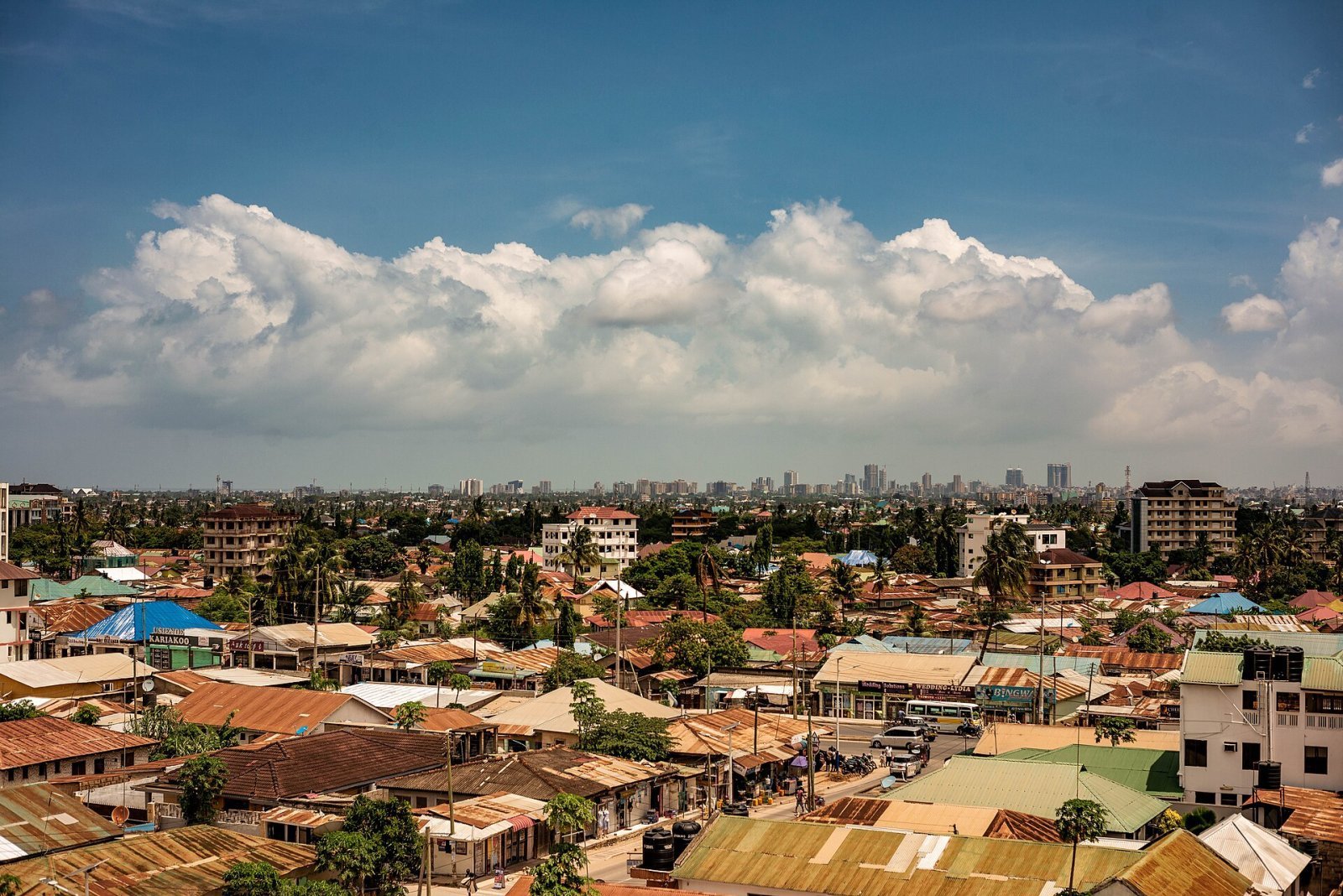
DAR ES SALAAM — Tanzania's Ministry of Lands, Housing and Human Settlements Development has published the Sinza Redevelopment Plan 2026 to 2046, a 20-year strategic framework for the 336.78 hectares of Sinza Ward in Ubungo Municipality, and the data it contains about the current state of one of Dar es Salaam's most commercially active urban districts is as analytically significant as the future it proposes.
The plan was prepared by the Ministry in collaboration with Ubungo Municipal Council and released as a draft in March 2026, with public consultations currently underway across the five sub-wards of Sinza A, B, C, D, and E. Its 146 pages of baseline surveys, population projections, soil bearing capacity analysis, building height zoning, financing models, and implementation strategies constitute the most comprehensive official urban planning document produced for any Dar es Salaam neighbourhood in recent history, and its findings demand reading with the specificity whose absence from most urban redevelopment announcements prevents the honest assessment that investors, developers, and the 31,396 residents whose neighbourhood is the plan's subject require.
How Sinza got here: the 1973 plan and what became of it
Sinza was planned in 1973 under the Government's Site and Services Project, implemented in collaboration with the World Bank, with the specific objective of providing serviced residential plots for low-income households relocated from Manzese during the Manzese Squatter Upgrading Project. The plan approved in January 1974 under Town Planning Drawing No. 1/73/174 designated standard residential plots of 288 square metres for single-storey, single-family dwellings, with areas set aside for public open spaces and water kiosks. The Tanzania Housing Bank, established in 1972, financed the construction of standardised "Sinza Type" houses with split-level roofs.
What happened next is the urban planning story whose repetition across African cities makes it familiar but whose Sinza-specific documentation makes it analytically useful. The original low-income beneficiary intent was not achieved: many developers who received plots were middle- and high-income earners rather than the relocated Manzese residents the project was designed to serve. Those higher-income residents purchased cars for which no parking was designated, and progressively converted the open spaces, water kiosk areas, and road reserves into the informal parking that the planning framework had not anticipated. Commercial activity expanded into residential zones without regulatory control. Multi-storey development began appearing without the coordinated planning whose absence the Ministry is now addressing.
The result, documented through field surveys completed in 2024 and published in the Sinza Redevelopment Plan, is a neighbourhood whose physical reality has diverged comprehensively from its 1973 planned configuration across every measurable dimension.
What the baseline survey found
The survey results are the plan's most analytically compelling component and the data whose honest presentation changes the nature of the investment and policy conversation from the aspirational to the specific.
Of 4,686 surveyed plots and buildings, 96.4% are completed buildings, 1.6% are vacant land, and 2% are under construction. The dominance of completed structures means Sinza is a mature, consolidated urban area with almost no horizontal expansion capacity remaining. Every growth pathway available to the district runs vertically rather than outward.
Of those completed buildings, 94% are single-storey structures. Only 6% are multi-storey. The plan's analysis of this finding is direct: the dominance of single-storey buildings reflects inefficient land utilisation in an area with high land value and increasing development pressure. In urban planning terms, 94% single-storey coverage in a centrally located district whose land value is among the highest in Ubungo Municipal Council is one of the clearest available definitions of underutilised urban land. The potential for value creation through densification is proportional to the gap between current use and optimal use, and Sinza's 94% single-storey baseline makes that gap very large.
Building ownership follows the pattern that makes the plan's implementation challenge as significant as its ambition. Private ownership accounts for 99.4% of all buildings. Public ownership accounts for 0.4% and institutional ownership for 0.2%. The government owns virtually none of Sinza. This single data point is the most important in the entire plan because it determines everything about how the redevelopment must proceed: it cannot be imposed, it must be incentivised, and the quality of the incentive framework whose design the plan's financing and partnership models attempt is the variable whose quality determines whether the plan's vision becomes Sinza's reality.
The residential tenure data adds a further dimension whose commercial implication for the high-rise apartment model is directly relevant. Of 4,686 surveyed residents, 63% are tenants and only 28.9% are owner-occupiers. The 63% tenant majority confirms that Sinza's housing market is rental-dominated, that demand for rental units is structurally established, and that high-rise apartment development whose commercial model is rental income rather than sales will find the existing market demand whose presence makes the investment case financially rational rather than speculative.
The population trajectory and what it implies for planning
Sinza's population declined from 40,546 in 2012 to 31,396 in 2022, a decrease whose cause the plan attributes to the commercial land use conversion that has been displacing residential occupancy as businesses replace households in the properties that the 2015 to 2024 land use change data documents. The plan records 29 applications for change of use from residential to commercial or mixed-use between 2015 and 2024, confirming that the market has been organically producing the mixed-use transformation that the plan is now attempting to formalise and regulate.
Under the redevelopment framework, Sinza's population is projected to grow to 71,489 by 2046, more than doubling the current 31,396 through the high-density residential development whose accommodation in 20-floor mixed-use buildings requires a fraction of the horizontal land area that equivalent population housed in the existing single-storey building stock would demand. The 71,489 projected population creates the utility infrastructure planning baseline whose specific service delivery targets the plan documents: 95 to 100% water supply coverage serving up to 71,489 people, 60 to 70% sewerage coverage serving 42,893 to 50,042 people, 95 to 100% electricity coverage serving 16,978 to 17,872 households, and 90 to 100% public transport access serving 64,340 to 71,489 people by 2046.
The building height framework and the soil constraint that limits it
The Sinza Redevelopment Plan's proposed building height framework is more precisely differentiated than the simplified "up to 20 floors" summary that the initial announcement produced, and the soil bearing capacity analysis whose findings constrain the framework's application is the engineering reality that any investor or developer evaluating Sinza's high-rise potential must understand before committing capital to a development whose structural viability depends on the ground beneath it.
The plan establishes five building height categories. Low-rise buildings cover 2 to 4 storeys. Medium-rise buildings cover 4 to 6 storeys. The first high-rise category covers 8 to 10 storeys. The second high-rise category covers 10 to 15 storeys. Very high-rise and landmark buildings reach up to 20 storeys.
The soil bearing capacity analysis maps the 336.78 hectares of Sinza across three suitability categories whose distribution determines where each height category can be applied. Low bearing capacity areas constitute 30.6% of the total area and are suitable only for 1 to 2 storey development. Moderate bearing capacity areas constitute 42.73% of the total area and can support 3 to 8 storey development. High bearing capacity areas constitute 26.67% of the total area and can support 10 to 15 storey development. The 20-floor landmark category requires a minimum plot size of 4,000 square metres and a floor area ratio of 5.0 to 7.0, meaning its application is restricted to the specific high-bearing-capacity zones whose geotechnical confirmation requires a site-specific investigation before any permit is issued.
The practical implication of the soil constraint is that Sinza's high-rise potential is concentrated in the 26.67% of the area with high bearing capacity rather than distributed uniformly across the neighbourhood. The 42.73% with moderate capacity represents the largest and most accessible development opportunity, supporting the 4 to 8 storey medium and lower high-rise buildings that require moderate plot sizes, moderate capital, and the plot amalgamation whose achievement is more practically manageable at 4 to 8 storey scale than at 20-storey scale.
The water pipeline constraint adds a further geographic restriction whose significance is precise and consequential. Two major potable water pipelines traverse Sinza with diameters of 21 inches and 33 inches respectively. The plan documents 91 plots intersecting the 21-inch pipeline and its buffer zones in Sinza B and Sinza C. No building, structure, or excavation is permitted directly above these pipelines. Buffer zones of 5 to 10 metres on either side must be maintained free from permanent structures. Developers proposing development near the pipelines must coordinate with DAWASA before undertaking any excavation or land modification.
Why plot amalgamation is mandatory, not optional
The plan's most consequential policy decision, and the one whose implications for Sinza's existing 99.4% private ownership are most directly relevant to every plot owner evaluating their participation, is that plot amalgamation is mandatory rather than optional for all development above 8 to 10 storeys.
The original 288 square metre plots that the 1973 plan allocated are too small to support the high-rise mixed-use development whose construction the redevelopment envisions. A 20-floor building requires a minimum plot of 4,000 square metres. An 8 to 10 storey building requires a minimum plot of 1,200 to 2,000 square metres. Sinza's original plots, and the great majority of its current plot configurations, fall well below these minimums. The only available mechanism for creating the plot sizes that high-rise development requires is amalgamation: combining adjacent plots into the larger parcel whose dimensions match the structural and planning requirements.
The plan is explicit that no high-rise building permits will be issued unless plot amalgamation requirements are satisfied and approved by the local authority. Plot amalgamation shall be mandatory and supported by a formal legal and regulatory framework to ensure effective implementation. Amalgamation within a given block will depend on the intended land use, the height of existing buildings, the proposed number of storeys, and the findings of land capacity and infrastructure load analysis for the respective area. Back-to-back plots within a defined block are the priority configuration, and the process will encourage joint venture development arrangements among multiple landowners within the block.
The mandatory character of the amalgamation requirement transforms the redevelopment from a voluntary participation model into a regulated planning obligation, but one whose enforcement mechanism is permit-based rather than compulsory acquisition-based. Existing plot owners who do not participate in amalgamation retain their land and their right to develop it, but they cannot access the high-rise development permits whose issuance requires the amalgamated plot that single-plot ownership cannot provide.
The revenue model that makes participation commercially rational
The plan's financial modelling of the returns that plot amalgamation and joint development generate for existing Sinza plot owners is the single most important communication to the private landowners whose voluntary participation the mandatory amalgamation requirement must incentivise rather than compel.
The plan models a 20-floor mixed-use building constructed on 2,000 square metres formed from the amalgamation of eight plots. The building's proposed use allocation is three floors of commercial space, five floors of office space, and twelve floors of residential apartments producing 72 units of approximately 200 square metres each. At current Sinza rental market rates, the commercial floors generate TZS 108 million to TZS 180 million per month. The office floors generate TZS 120 million to TZS 240 million per month. The 72 residential apartments at TZS 500,000 to TZS 800,000 per unit per month generate TZS 36 million to TZS 57 million per month. The total monthly revenue from the 20-floor building is estimated at TZS 264 million to TZS 477 million.
Distributed equally across eight plot owner partners, each owner receives TZS 33 million to TZS 59.625 million per month. Against the current income that a 288 square metre single-storey plot in Sinza generates at prevailing rental rates, the differential is the commercial argument for participation whose persuasiveness the plot owner community must find sufficient before the amalgamation programme achieves the voluntary uptake that the mandatory permit requirement is designed to accelerate but cannot by itself guarantee.
The open space crisis that the plan must also address
The baseline data on Sinza's open space reveals a loss whose scale makes the environmental quality argument for redevelopment more urgent than the commercial argument alone. In 1973, public open spaces occupied 6.8% of Sinza's total land area. By 2024, open space coverage has declined to 0.88%. The community centre land originally designated at 1.4% of total area has been completely converted to commercial use with none remaining. Approximately 75% of the areas allocated for water kiosks have been developed in ways that deviate from the original approved plans.
The plan's open space proposal allocates 6 hectares for open space, 3.45 hectares for playgrounds, and 2.5 hectares for recreation areas in the 2026 to 2046 framework, recovering the green space provision whose loss the previous five decades of unplanned development produced. The 23.37 hectares of unplanned settlement along the Ng'ombe River reserve area, which the plan designates as reserved land for that river corridor, represents the most ecologically sensitive component of the redevelopment whose treatment requires the 30 to 50 metre buffer zone that environmental regulations mandate alongside the clearance of the unplanned residential development that currently occupies the river reserve.
The road width constraint compounds the environmental challenge. The plan documents that 86.9% of roads in Sinza are too narrow at 3 to 6 metres. All roads with widths of 4 to 6 metres lack stormwater drainage, pedestrian walkways, and cycling lanes. The plan's road widening proposals, whose implementation requires the road reserve protection that existing encroachment has compromised, are the physical infrastructure investment whose absence makes high-rise development unsafe for the pedestrian, vehicle, and emergency service circulation that density creates.
The three-phase implementation and the coordination body
The Sinza Redevelopment Plan implements across three phases whose sequencing reflects the logical progression from legal and regulatory preparation through major construction to full consolidation.
Phase 1 covers 2026 to 2031 and focuses on the planning and enabling conditions: land tenure regularisation and cadastral surveys, preparation of Detailed Local Area Plans, infrastructure upgrading in priority zones, community sensitisation, and pilot redevelopment projects whose execution establishes the proof of concept that subsequent phases require to attract the private investment at scale.
Phase 2 covers 2032 to 2038 as the major redevelopment phase: large-scale redevelopment of high-density residential areas, construction of mixed-use developments along major corridors including Sam Nujoma Road, Shekilango Road, and Sinza Mori Road, upgrading of social and economic infrastructure, and implementation of PPP-led housing projects whose financing the capital markets' confidence in the Phase 1 outcomes is expected to support.
Phase 3 covers 2039 to 2046 as the consolidation and sustainability phase: completion of redevelopment in remaining areas, enhancement of public transport integration, environmental restoration and open space development, and a comprehensive review and updating of the redevelopment plan whose original assumptions the two preceding decades of implementation will have tested against the market and regulatory realities whose evolution no 20-year plan can fully anticipate.
Implementation coordination will be managed through the Sinza Redevelopment Coordination Unit, a dedicated body established under the Local Authority working in collaboration with the Ministry responsible for Lands, utility agencies covering water, sewerage, roads, and electricity, private developers, and community organisations and residents whose participation the plan requires at every phase rather than as a pre-construction formality.
The financing model the plan recommends
The plan evaluates five financing models: lease financing, joint venture PPP, sale agreement, mortgage financing, and self-financing. Its analysis of each model's advantages and disadvantages leads to a specific recommendation: a hybrid combining joint venture and leasehold arrangements is the most suitable approach for Sinza's ownership structure.
The joint venture model asks landowners to contribute their plots as equity while developers contribute capital, technical expertise, and construction services. Profits are distributed proportionally to each party's equity contribution. The leasehold component applies to the strategic public land whose minimal proportion in Sinza's 0.4% public ownership makes it a small but institutionally significant component of the financing architecture.
The hybrid recommendation reflects the specific challenge that 99.4% private ownership creates for any alternative model. Pure government-led redevelopment has no land base. Pure private investor acquisition requires compulsory purchase that the government has committed not to exercise. Pure self-financing by plot owners is impractical at the amalgamated plot scales that high-rise development requires. The joint venture model is the mechanism whose design distributes both the capital requirement and the financial return across the landowner and developer partners in proportions that make participation commercially rational for both.
The plan's most important commitment and its most important test
The government's commitment that no land will be compulsorily acquired from existing owners is the political and legal foundation whose credibility makes every other component of the plan's implementation viable. Without it, Sinza's 99.4% private landowners have every incentive to resist rather than participate. With it, the plan's persuasion task becomes commercial rather than coercive: demonstrating that TZS 33 million to TZS 59.625 million per month per plot owner from a 20-floor joint venture building is a more attractive outcome than the current single-storey rental income, and that the mandatory amalgamation requirement's permit-based enforcement is the regulatory structure whose respect makes participation in the scheme commercially superior to holding out.
Whether Sinza's 99.4% private landowners find those terms sufficiently compelling to participate voluntarily at the scale and pace that the 20-year plan's three-phase implementation requires is the question whose answer will determine whether the Sinza Redevelopment Plan 2026 to 2046 becomes the framework through which Dar es Salaam's most underutilised centrally located district is transformed into the mixed-use high-density neighbourhood that its land value, commercial activity, and location have been building toward organically since 1973, or whether it joins the long list of urban plans whose ambition exceeded the institutional capacity and commercial incentives whose combination makes voluntary participation in complex urban redevelopment achievable in cities where the government does not own the land it wants to transform.
FAQ
What is the Sinza Redevelopment Plan 2026 to 2046? The Sinza Redevelopment Plan 2026 to 2046 is a 20-year strategic urban planning framework prepared by Tanzania's Ministry of Lands, Housing and Human Settlements Development in collaboration with Ubungo Municipal Council. It covers 336.78 hectares across Sinza A through E in Ubungo Municipality, Dar es Salaam, and provides the building height zoning, land use proposals, plot amalgamation framework, financing models, and implementation strategies for transforming Sinza from a predominantly single-storey residential and informal commercial district into a planned high-density mixed-use urban neighbourhood.
What does the baseline survey data reveal about Sinza's current state? Of 4,686 surveyed plots and buildings, 94% are single-storey structures and only 6% are multi-storey. 96.4% of plots are completed buildings with only 1.6% vacant land. 99.4% of all buildings are privately owned. 63% of residents are tenants. Sinza's population declined from 40,546 in 2012 to 31,396 in 2022 due to commercial land use conversion displacing residential occupancy, and is projected to grow to 71,489 by 2046 under the redevelopment framework.
Why is plot amalgamation mandatory and what does it require? Plot amalgamation is mandatory because Sinza's original 288 square metre plots are too small to support the high-rise development the plan envisions. A 20-floor building requires a minimum 4,000 square metre plot. No high-rise building permits above 8 to 10 storeys will be issued unless amalgamation requirements are satisfied and approved by the local authority. Amalgamation combines adjacent plots within a defined block into a larger unified parcel whose dimensions meet the structural and planning requirements for the proposed development height.
What returns can existing Sinza plot owners expect from participation? The plan models a 20-floor mixed-use building on 2,000 square metres from eight amalgamated plots generating total monthly revenue of TZS 264 million to TZS 477 million from commercial, office, and residential rental income. Each plot owner in an eight-plot partnership receives an estimated TZS 33 million to TZS 59.625 million per month. The plan recommends a hybrid joint venture and leasehold financing model where landowners contribute plots as equity, developers contribute capital and expertise, and profits are distributed proportionally.
Will existing Sinza residents and plot owners lose their land? The government has confirmed that the redevelopment will not involve compulsory acquisition of land from existing owners. No land will be taken. The mandatory amalgamation requirement applies to permit issuance for high-rise development rather than to land ownership, meaning existing owners who do not wish to participate retain their land and their right to develop it at the permitted height for their specific soil bearing capacity zone, but cannot access the high-rise development permits whose issuance requires the amalgamated plot that single-plot ownership cannot provide without voluntary combination with adjacent plot owners.
What are the soil constraints on building heights in Sinza? The soil bearing capacity analysis maps Sinza across three zones. Low bearing capacity areas, 30.6% of the total, are suitable for only 1 to 2 storey development. Moderate bearing capacity areas, 42.73% of the total, support 3 to 8 storey development. High bearing capacity areas, 26.67% of the total, support 10 to 15 storey development. The 20-floor landmark category is restricted to specific high-bearing-capacity zones confirmed by geotechnical investigation before permit issuance. Additionally, no construction is permitted above the two major water pipelines of 21-inch and 33-inch diameter traversing Sinza B and C, with 91 plots affected by the 21-inch pipeline and its buffer zones.
 Uchumi360
Business Intelligence
Uchumi360
Business Intelligence
- Tanzania Ministry of Lands, Housing and Human Settlements Development in collaboration with Ubungo Municipal Council, Sinza Redevelopment Plan 2026 to 2046, Draft Report, March 2026
- All baseline survey data, population statistics, building height categories, soil bearing capacity analysis, land use tables, financing models, implementation phases, and revenue projections cited directly from this official document
- Available through Ministry of Lands official communications
- Population data: Sinza 40,546 residents 2012, 31,396 residents 2022, projected 71,489 by 2046
- Source: Sinza Redevelopment Plan 2026 to 2046, Chapter 2
- Building stock data: 4,686 surveyed plots, 96.4% completed buildings, 1.6% vacant land, 94% single-storey, 6% multi-storey
- Source: Sinza Redevelopment Plan 2026 to 2046, Chapters 3 and 7
- Building ownership: 99.4% private, 0.4% public, 0.2% institutional
- Source: Sinza Redevelopment Plan 2026 to 2046, Chapter 7
- Resident tenure: 63% tenants, 28.9% owners
- Source: Sinza Redevelopment Plan 2026 to 2046, Chapter 7
- Soil bearing capacity: 30.6% low, 42.73% moderate, 26.67% high
- Source: Sinza Redevelopment Plan 2026 to 2046, Chapter 7
- Water pipeline: 21-inch and 33-inch diameter, 91 plots intersecting 21-inch pipeline in Sinza B and C
- Source: Sinza Redevelopment Plan 2026 to 2046, Chapter 7
- Open space decline: 6.8% in 1973 to 0.88% in 2024
- Community centre land completely converted
- 75% of water kiosk areas developed in violation of plans
- Source: Sinza Redevelopment Plan 2026 to 2046, Chapters 3 and 7
- Road width: 86.9% of roads 3 to 6 metres wide
- Source: Sinza Redevelopment Plan 2026 to 2046, Chapter 7
- Revenue modelling: 20-floor building TZS 264 million to TZS 477 million per month total, TZS 33 million to TZS 59.625 million per plot owner per month
- Source: Sinza Redevelopment Plan 2026 to 2046, Chapter 12
- Implementation phases: Phase 1 2026 to 2031, Phase 2 2032 to 2038, Phase 3 2039 to 2046
- Sinza Redevelopment Coordination Unit
- Source: Sinza Redevelopment Plan 2026 to 2046, Chapter 10
- Financing model recommendation: hybrid joint venture and leasehold
- Source: Sinza Redevelopment Plan 2026 to 2046, Chapter 12
- Town Planning Drawing No
- 1/73/174: Sinza Layout, approved January 1974
- Original 1973 planning context
- Source: Sinza Redevelopment Plan 2026 to 2046, Chapter 1
- Dar es Salaam Master Plan 2016 to 2036, infill and densification designation for Sinza
- Referenced in Sinza Redevelopment Plan 2026 to 2046
- Human Settlements Development Policy 2000, vertical and compact urban development framework
- Referenced in Sinza Redevelopment Plan 2026 to 2046
- National Bureau of Statistics Tanzania, 2012 and 2022 census population data
- Available at nbs.go.tz
- World Bank, Tanzania Site and Services Project 1973, Manzese Squatter Upgrading Project context
- Available at worldbank.org
Uchumi360 covers business, investment, and economic policy across East, Central, and Southern Africa.
For the serious reader
You read to the end. That places you in a small group.
Uchumi360 is built for readers who demand precision over speed, structure over sentiment, and analysis that holds uncomfortable conclusions rather than softening them. If this work sharpens how you think about Africa's economy, help us keep building the infrastructure behind it.
Institutional Partners
Commission intelligence. Shape the conversation.
Uchumi360 works with development finance institutions, investment firms, sovereign bodies, and strategic organisations across the coverage region. Institutional partnership unlocks:
- Commissioned sector and country intelligence reports
- Branded research series under your institution's authority
- Exclusive data briefings for internal strategy teams
- Speaking and editorial presence at Uchumi360 events
- Co-published investment outlooks for your markets
Support Our Work
Independent analysis has a cost. Help us bear it.
Uchumi360 does not carry advertising. It does not take editorial direction from sponsors. Every article is produced without commercial compromise. Your contribution funds the reporting, research, and editorial infrastructure that keeps this analysis free from influence.
Secure checkout: One-time and monthly support are processed securely.
Stay Connected
Keep up with every new insight.
Follow our latest analysis, policy coverage, and market intelligence as soon as it is published. If you need something specific, reach out directly and we will point you to the right research.
