Digital Mapping and Infrastructure Transparency: A New Tool Against Cost Overruns
Emerging digital mapping technologies, including Geographic Information Systems (GIS), drones, satellite imagery, and 3D modelling, offer a transformative opportunity. By providing real-time project monitoring, precise planning, and spatial analytics, these tools enable government agencies, contractors, and citizens to track progress, detect irregularities, and make informed decisions. In doing so, they can reduce corruption, improve efficiency, and ensure that infrastructure delivers maximum economic and social value.
Public infrastructure projects are among Tanzania’s largest and most strategic expenditures, encompassing roads, bridges, airports, water supply systems, and energy projects. Yet, despite their scale and importance, many projects experience cost overruns, delays, and quality issues. Limited transparency, fragmented project management, and weak oversight contribute to inefficiencies that drain public resources.
Emerging digital mapping technologies, including Geographic Information Systems (GIS), drones, satellite imagery, and 3D modelling, offer a transformative opportunity. By providing real-time project monitoring, precise planning, and spatial analytics, these tools enable government agencies, contractors, and citizens to track progress, detect irregularities, and make informed decisions. In doing so, they can reduce corruption, improve efficiency, and ensure that infrastructure delivers maximum economic and social value.
Benefits of Digital Mapping in Infrastructure Projects
1. Precise Land-Use Planning and Route Optimization
Digital mapping enables planners to visualize terrain, land ownership, environmental constraints, and existing utilities. For roads, railways, and pipelines, GIS-based route optimization minimizes unnecessary detours, reduces construction costs, and lowers environmental impacts. Early identification of challenges such as flood zones or protected areas allows for better project design and risk mitigation.
2. Real-Time Construction Monitoring and Quality Control
Drones and satellite imagery provide live monitoring of construction sites, capturing progress, workforce deployment, and material usage. This enables project managers to identify delays, detect deviations from blueprints, and ensure that engineering standards are consistently met. By reducing human error and enhancing accountability, these tools directly help in preventing cost overruns.
3. Enhanced Public Oversight and Transparency
Digital dashboards that display GIS maps, project timelines, and expenditure tracking allow citizens, media, and civil society to monitor public projects in real-time. This transparency strengthens accountability, deters corruption, and empowers communities to participate actively in development decisions. When citizens can see progress, fund allocation, and project outcomes, trust in public institutions increases.
Case Examples from Tanzania
Pilot projects in Dodoma and Dar es Salaam demonstrate the impact of digital mapping on project efficiency:
- Road construction in Dodoma: Real-time drone monitoring enabled early detection of deviations from the approved road alignment, reducing rework and preventing unnecessary cost overruns. Preliminary reports indicated up to 15% reduction in budget overruns.
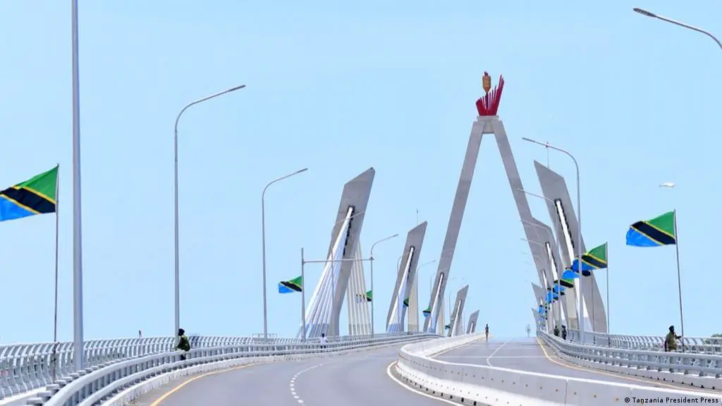
- Bridge construction in Dar es Salaam: GIS-based site planning helped avoid land disputes and optimize foundation placement, contributing to on-time completion and improved structural quality.
- Utility network mapping: Early pilot programs for water and electricity networks have shown that GIS mapping improves coordination among ministries and reduces duplication of efforts.
These examples highlight that digital mapping is not only a planning tool but a powerful instrument for governance and economic efficiency.
Way Forward: Institutionalizing Digital Mapping
To fully harness the potential of digital mapping, Tanzania should adopt a comprehensive, institutionalized approach:
1. Integrate Digital Mapping Across Ministries
All infrastructure-related agencies, roads, water, energy, and urban development should embed GIS, drone surveillance, and satellite monitoring into their project management processes. A unified national geospatial platform can improve coordination and reduce duplication.
2. Develop Public Dashboards for Citizen Engagement
Open-access dashboards displaying project timelines, budgets, and maps empower citizens and civil society to monitor infrastructure projects, creating a culture of accountability and participatory governance.
3. Invest in Capacity Building and Training
Government engineers, planners, and local contractors must be trained in GIS, drone operations, and data analytics. This ensures that digital mapping is effectively applied rather than treated as a technical novelty.
4. Encourage Public-Private Collaboration
Private technology firms can provide drones, satellite services, and analytics tools under partnerships or service contracts. This approach leverages innovation while reducing government expenditure on equipment acquisition.
5. Establish Regulatory Standards for Digital Infrastructure Management
Clear guidelines for data collection, storage, and sharing will enhance interoperability, ensure accuracy, and protect sensitive information. Standardization also facilitates long-term integration of digital mapping across all projects.
Outlook
Digital mapping represents a paradigm shift in infrastructure governance. By improving planning accuracy, monitoring construction quality, and enabling public oversight, it can reduce cost overruns, prevent corruption, and ensure projects are completed on time and within budget.
For Tanzania, institutionalizing these technologies offers a strategic lever for economic growth, enabling the country to deliver infrastructure that supports trade, industrialization, urban development, and climate resilience. Ultimately, a digitally mapped and transparent infrastructure sector strengthens both public trust and Tanzania’s economic competitiveness.
